
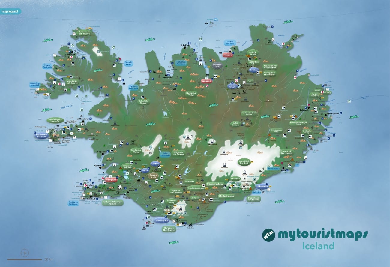
Interactive travel and tourist map of Iceland: click on icons and writings on the map to open web links.
Welcome to the land of fire and ice, where nature constantly reminds you who’s really in charge. Iceland is home to more than 10 thousand waterfalls, around 130 volcanoes (of which about 30 are active), Europe’s largest glacier, vast lava fields, black sand beaches, steaming geothermal areas and landscapes that often feel like another planet.
If you’re visiting between autumn and spring, keep an eye on the sky – you may be lucky enough to witness the magical Northern Lights dancing overhead. Along the coast, whales are a common sight, while during the summer months the colourful puffins steal the show on dramatic sea cliffs.
Don’t be surprised if you find yourself sharing the road with some of the biggest super jeeps you’ll ever see. These enormous modified 4x4s are built to conquer Iceland’s glaciers, rivers and rugged highlands, and they’re as much a part of the country’s culture as its volcanoes.
A challenge for adventurous food lovers: don’t leave Iceland without trying hákarl (fermented shark), probably the most disgusting food I have ever tried in my life. The locals will tell you to wash it down with a shot of Brennivín- and trust me, you’ll understand why after the first bite!
Population: 394.324
Area: 103.125 sq.Km
Official Language: Icelandic
Currency: Icelandic Kròna
Driving Lane: Right
When to go: All year
FURTHER LINKS
Safetravel – Be Safe in Iceland
IRCA – Road Conditions map
Veagerdin – Road info
Weather Forecasts – Icelandic Met Office
Discover Iceland’s best tourist attractions and top sights through our map! Which are the best places to visit in Iceland and the best things to do in Iceland? Simply click on the map’s links to be quickly redirected to images and useful websites for accommodation, activities, transport and much more about Iceland travel.
Best Places to Visit in Iceland
Our tourist map of Iceland highlights many of the country’s most spectacular places to visit, from the lively capital of Reykjavík to the dramatic landscapes of the Golden Circle, the waterfalls and black sand beaches of the South Coast, and the glaciers surrounding Vatnajökull. Travellers can also explore the volcanic landscapes of Snæfellsnes, the geothermal areas around Mývatn, the remote Westfjords and the scenic Eastfjords. The map is designed to help you discover Iceland’s main tourist attractions, natural wonders, waterfalls, volcanoes, glaciers, beaches and scenic areas, making it easier to plan a road trip and decide which parts of the country to explore.
Best Time to Visit Iceland
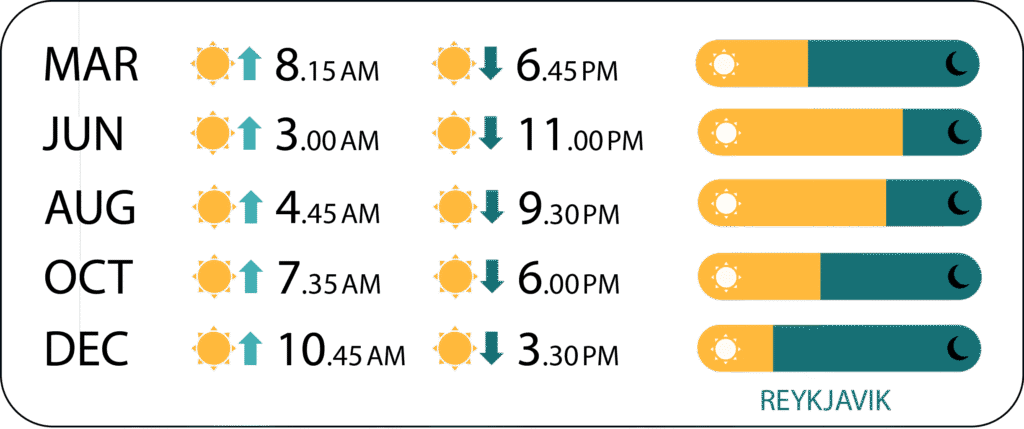
Iceland can be visited throughout the year, but each season offers a very different experience. Summer brings long daylight hours and easier access to many parts of the country, including some of the highland roads, while winter is the best season for a chance to see the Northern Lights. Spring and autumn offer fewer visitors and changing landscapes, although weather and road conditions can be unpredictable. If you are planning to explore Iceland by car, always check local weather and road conditions before travelling, particularly during the colder months.
Driving and Exploring Iceland
A tourist map of Iceland is particularly useful for planning a road trip around the country. The famous Ring Road connects many of Iceland’s major towns and attractions, while numerous smaller roads lead to waterfalls, beaches, viewpoints and other natural wonders. Some mountain roads, known as F-roads, are only accessible during the warmer months and generally require a suitable 4×4 vehicle. Distances between attractions can also be greater than they appear on a map, so allow plenty of time when planning your itinerary.
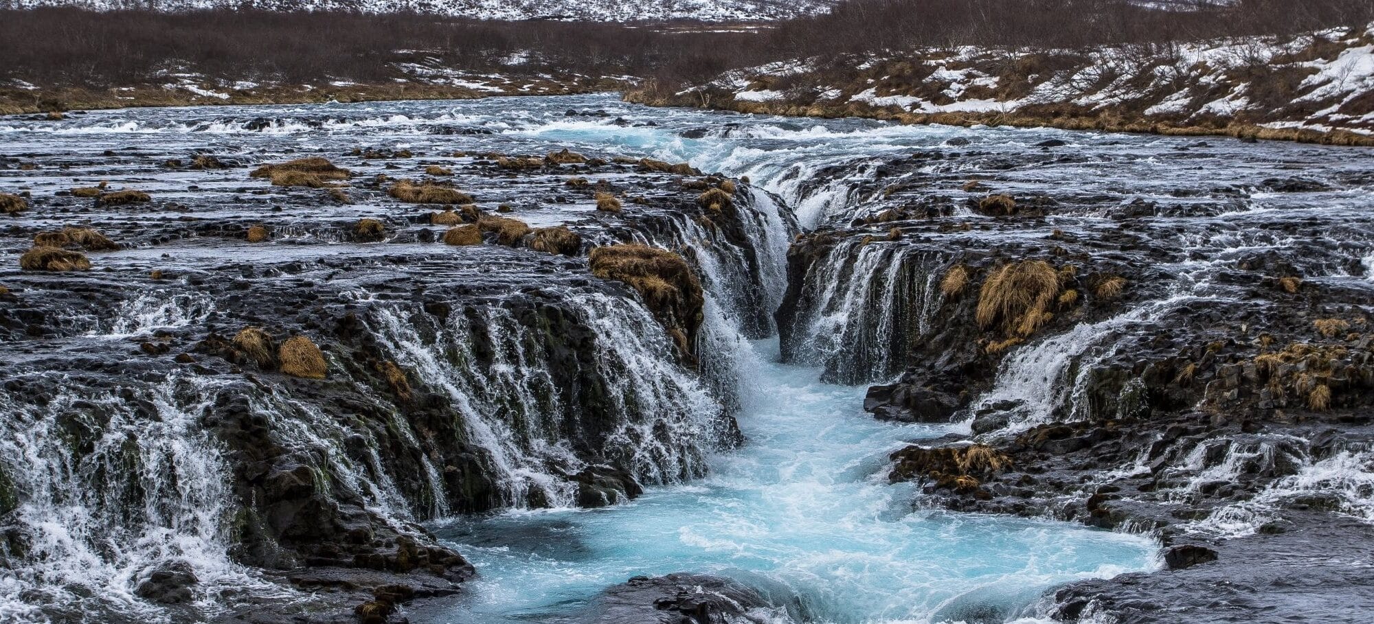
photo © mytouristmaps (Brùarfoss)