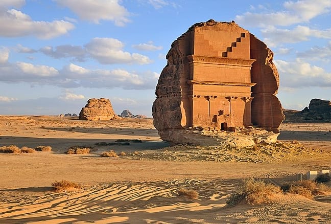
Also known as Al-Ḥijr or Hegra, this impressive archaeological site belonged in the first century AD to the kingdom of Nabatean, a nomadic Bedouin tribe of the northern Arabian peninsula, whose capital was Raqmu, now known as the famous Petra (Jordan).
According to the Quran, it is believed that this is a cursed place, owing to the punishment with natural disasters given from Allah to the Thamud people (8th century BCE) for their idol worshipping.
The outstanding location consists of 131 rock-cut monumental tombs and was the first Arabian proclaimed UNESCO World Heritage Site in 2008.
The site is reachable by car from the nearest towns with flight connections: al-Wajh (100 km) and al-Ula (20 km).
All visitors need a permit to visit Mada’in Saleh (you can easily obtain the permission in the Hotels near the site).
Some of Northern Ireland’s neighbourhoods are still divided by physical barriers known as Peace Walls or Peace Lines. Most of them are located in Belfast, particularly in areas where predominantly nationalist and loyalist communities live close to one another. Other interface barriers can also be found in places such as Derry/Londonderry, Portadown and Lurgan.
The barriers are one of the most visible reminders of the Troubles, the period of political and sectarian conflict in Northern Ireland that lasted from the late 1960s until the 1990s. Although the Good Friday Agreement of 1998 brought an end to most of the large-scale violence, many of the physical divisions between communities remained.
Why were the Peace Walls built?
The first Peace Wall was erected in Belfast in 1969, following some of the worst violence of the early years of the Troubles. The disturbances involved nationalist and loyalist communities as well as the security forces, and resulted in widespread destruction and displacement.
The original intention was for many of these barriers to be temporary. They were designed to separate communities and prevent people from crossing into areas where they could become targets of violence, while also reducing the risk of attacks being launched across community boundaries.
Over the following decades, however, temporary barriers became much more permanent. New walls, fences, gates and other forms of defensive architecture were constructed in areas where tensions remained particularly high.
The term “Peace Wall” can therefore refer to quite different structures. Some are substantial brick or concrete walls, while others consist of metal fencing, gates or combinations of different barriers.
Where are the Peace Walls?
Belfast has by far the largest concentration of Peace Walls and other interface barriers. They can be found in several parts of the city, including west, north and east Belfast.
Some of the best-known examples include the Cupar Way Peace Wall, which separates the Shankill and Falls areas, and barriers around Springmartin, Springfield, Ardoyne and Short Strand.
There are also interface structures elsewhere in Northern Ireland, including Derry/Londonderry, Portadown and Lurgan.
It is difficult to give one definitive figure for the total number of Peace Walls because there is no single official definition covering every wall, fence, gate and other defensive structure. Different organisations have therefore produced different totals.
The Northern Ireland Department of Justice has a specific programme covering 59 interface security structures under its responsibility. Other research and community organisations identify a larger number of barriers and forms of defensive architecture across Northern Ireland.
Peace Walls after the Good Friday Agreement
The Good Friday Agreement, signed on 10 April 1998, represented a historic turning point for Northern Ireland and significantly reduced political violence.
However, the agreement did not immediately remove the physical divisions between communities. In many areas, residents continued to have concerns about security and possible outbreaks of violence.
As a result, many Peace Walls remained in place even as Northern Ireland became considerably more peaceful.
The continued existence of these structures demonstrates that political peace and physical integration are not necessarily the same thing. In some neighbourhoods, communities remain largely segregated in terms of housing, schools and everyday life.
Are the Peace Walls being removed?
Yes, but much more slowly than originally expected.
In 2013, the Northern Ireland Executive’s Together: Building a United Community strategy established an ambitious objective of removing all interface structures by 2023, where communities could agree to their removal.
The Department of Justice subsequently established its Interface Programme to work towards reducing or removing these barriers. The original programme explicitly referred to the 2023 target.
However, the 2023 target was not achieved.
The removal process has instead become a gradual, community-led programme. Rather than simply taking down every wall, authorities work with residents and community organisations to determine whether an individual barrier can be removed, reduced, modified or replaced with a less restrictive structure.
According to the Northern Ireland Executive’s 2024–25 reporting, around one-third of the 59 official interface security structures had been removed and another third had been reduced. Work was continuing on the remaining locations.
The Department of Justice also reported that three interface security structures were removed during 2024–25, following consultation with communities and statutory partners.
One example is Flax Street in north Belfast. Two solid interface barriers were removed and replaced with vehicular and pedestrian gates, allowing local people to pass through for much of the day while retaining a level of security when required.
Another important example came in Portadown, where a 3-metre-high interface structure that had stood for 27 years was removed following extensive consultation with local communities.
In Derry/Londonderry, most of the remaining interface security structures along Derry’s Walls have also now been removed. Current projects include work at Donaldson Crescent, Springmartin Gate and Holy Cross in Belfast.
Will all the Peace Walls disappear?
There is currently no new fixed deadline for removing all the Peace Walls.
This is an important change from the original 2023 objective. The emphasis is now on achieving reductions or removals where there is sufficient support from the communities affected.
For some residents, the walls remain reassuring because they provide a physical separation from neighbouring communities and are associated with protection from possible violence. For others, they are an unwanted reminder of the Troubles and continue to reinforce the division between communities.
This makes removing them considerably more complicated than simply demolishing a wall.
The Department of Justice continues to operate its Interface Programme, working with communities towards the reduction or removal of interface structures. Some barriers have therefore disappeared completely, while others have been shortened, replaced by gates or modified to make movement between communities easier.
Can you visit the Peace Walls?
Yes. The Peace Walls are one of the most unusual sights in Belfast, and several can be visited relatively easily.
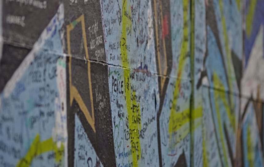
The most famous is the Cupar Way Peace Wall, where visitors can see hundreds of messages and signatures written on the wall. The area has become particularly associated with political murals and messages calling for peace.
However, visitors should remember that these are not simply tourist attractions. They are located in residential neighbourhoods where people live with the legacy of decades of conflict.
Some of the barriers also have gates controlling movement between communities. The opening arrangements vary considerably. The Department of Justice currently lists several gates with restricted opening hours, including barriers at North Howard Street, Northumberland Street, Townsend Street, Lanark Way, Workman Avenue and Flax Street.
It is therefore worth checking the current opening arrangements if you intend to walk through an interface area rather than simply view the walls.
The messages on the Peace Walls
Perhaps the most striking feature for visitors is the thousands of messages written on some of the walls.
Over the years, visitors from Northern Ireland and around the world have left messages expressing hopes for peace, reconciliation and an end to division.
The contrast is particularly powerful: structures originally created to separate communities have become places where people from completely different backgrounds leave messages calling for greater understanding.
At the same time, the continued existence of the walls shows that the legacy of the Troubles has not disappeared completely.
The physical barriers are gradually being reduced in some areas, but the process of removing them is ultimately dependent on rebuilding confidence between communities. As Northern Ireland continues to move further away from its violent past, the Peace Walls remain both a symbol of how far the country has come and a reminder of the divisions that have yet to disappear.
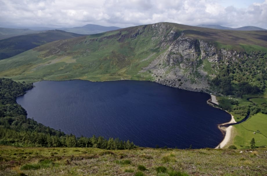
The Lough Tay, located in the Wicklow Mountains, about 50 km south from Dublin, is also known as the Guinness Lake due to its shape and colours.
The white sandy beach on the northern coast makes the Guinness foam. The brown colour of the water close to the beach (due to the water coming from the streams that rise on peat covered uplands) complete the incredible visual similarity to the famous Irish pint.
You can see the lake from the R759 scenic route, or if you want a better view from the top, take the walking trail towards the Luggala mountain (accessible from the R115 — the best scenic drive in the Wicklow mountains) or the Djouce mountain, one of the most spectacular walks in the Wicklow Mountains, from which you can see the whole Dublin bay and, on a clear sky day, also the Welsh coastline.
The Lough Tay beach was chosen in 2013 as the set for the village of Kattegat in the Vikings tv series.
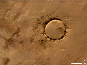
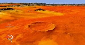
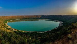
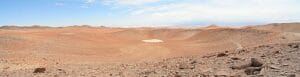
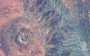
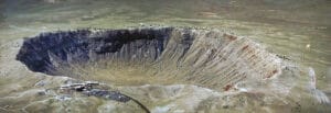
Impact craters on earth are difficult to preserve due to the continuous remodeling of the earth’s crust by orogenesis, plate tectonics and atmospheric agents.
There are around 180 recognizable impact craters on earth, of which about 60 are now buried under sediments, a considerably lower number, for example, compared to the 360.000 craters on Mars or the 7.000 on the moon. This thanks to the shield made by the earth’s dense atmosphere.
Some of them have caused catastrophes, such as the meteorite that carved the Chicxulub crater in Mexico: according to the theory currently accepted by the scientific community postulated by the physicist Luis Álvarez and his son geologist Walter Álvarez, is widely thought to have caused 65 million years ago the end of the dinosaurs due to a tsunami and dust emissions which totally covered the earth’s surface a cloud of dust for many years.
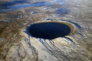
Others have instead brought wealth as the Popigai crater in Russia, whose impact transformed graphite into diamonds within about 13 km radius.
List of the biggest impact craters on earth:
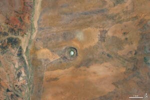
1. Vredefort Dome, South Africa: 160 km diameter, 2.02 billion years old. 2. Chicxulub crater, Mexico: 150 km diameter, 65 million years old. 3. Sudbury crater, Canada: 130 km diameter, 1.85 billion years old. 4. Popigai crater, Russia: 100 km diameter, 35 million years old. 5. Manicouagan crater, Canada: 100 km diameter, 214 million years old. 6. Acraman crater, Australia: 90 km diameter, 580 million years old. 7. Chesapeake Bay crater, USA: 85 km diameter, 35 million years old. 8. Morokweng crater, South Africa: 70 km diameter, 145 million years old. 9. Kara crater, Russia: 65 km diameter, 70 million years old. 10. Beaverhead crater, USA: 60 km diameter, 600 million years old.
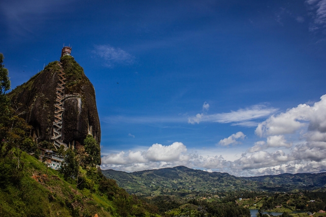
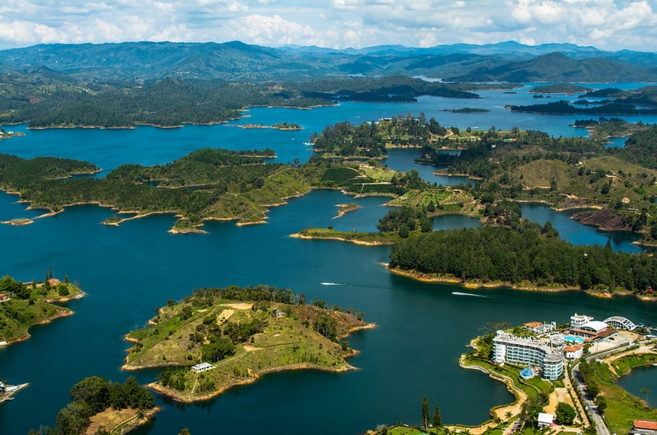
Also known as Stone of Peñol (since this rock formation is claimed by both the bordering towns of Peñol and Guatapé) the Rock of Guatapé is a granitic monolith located in the Peñol – Guatapé reservoir, about 40 km East of Medellìn, Colombia.
The rock is 200 meters high and it is surrounded by a magnificent lagoon, which is formed by the hydro-electric dam, built in the 1960-70s.
Visitors can reach the top of the rock climbing up the 650 steps on the stairway, enjoy the stunning view and visit two Benedictine monasteries.
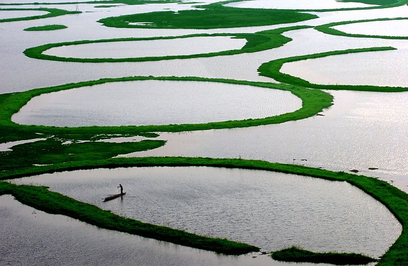
Also known as the Floating Lake, the Loktak Lake, located in Bishnupur district of Manipur, about 50 km south of the city of Imphal, is the largest freshwater lake in North-Eastern India.
With a surface of 290 square kilometres, it is famous and unique for its floating islands named phumdis: masses of soil, organic matter and vegetation that hosts several species of animals and aquatic plants including the Sangai, a brow-antlered deer, state animal of Manipur.
These phumdis are not just an aesthetic wonder but a functional ecosystem, supporting a variety of flora and fauna. The largest of these is the Keibul Lamjao National Park, the only floating national park in the world.
As a fragile ecosystem, Loktak Lake faces challenges from pollution, unsustainable fishing practices, and encroachments. Visitors are encouraged to practice responsible tourism—avoiding plastic waste, respecting the local culture, and supporting eco-friendly initiatives. By doing so, travellers can contribute to the preservation of this unique natural treasure for generations to come.
Loktak Lake is located approximately 50 kilometres from Imphal, the capital city of Manipur. The nearest airport is in Imphal, which is well-connected to major cities in India. From Imphal, you can hire a taxi or take a local bus to reach the lake. The journey itself is an experience, offering stunning views of Manipur’s lush hills and valleys.
The best time to visit Loktak Lake is between October and March when the weather is pleasant, and the migratory birds are in full attendance. During this period, the lake comes alive with vibrant activity, making it a perfect time for photography, sightseeing, and cultural exploration.
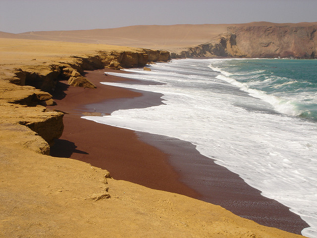
Located in the Paracas National Reserve, in the region of Ica, Peru, between Punta Santa Maria and Playa Lagunillas, the Playa Roja is a stunning beach where the pink granodiorite rocks form a unique landscape with red sandy beach and cliffs.
To reach Playa Roja, follow the trail leading to the entrance of the Paracas Reserve. After passing by the museum, also known as the “Centro de Interpretación,” proceed in the direction of Lagunillas. Upon reaching the Lagunillas checkpoint, continue until you arrive at Playa Roja.
Since Playa Roja is part of a protected reserve, amenities are minimal. It’s advisable to bring water, snacks, sunscreen, and a hat to protect against the strong sun. Comfortable walking shoes are also recommended if you plan to explore the surrounding cliffs.
The best time to visit Playa Roja is during the dry season, from April to November, when the weather is pleasant, and the skies are clear. Early mornings or late afternoons are particularly magical, with soft light enhancing the beach’s vibrant colors.
As part of a protected area, Playa Roja relies on visitors to maintain its pristine condition. Make sure to follow the “leave no trace” principle: take all your trash with you, avoid disturbing wildlife, and stick to designated paths to protect the fragile ecosystem.
This website uses cookies to improve your experience. We'll assume you're ok with this, but you can opt-out if you wish. Cookie settingsACCEPT
Privacy & Cookies Policy
Privacy Overview
This website uses cookies to improve your experience while you navigate through the website. Out of these cookies, the cookies that are categorized as necessary are stored on your browser as they are essential for the working of basic functionalities of the website. We also use third-party cookies that help us analyze and understand how you use this website. These cookies will be stored in your browser only with your consent. You also have the option to opt-out of these cookies. But opting out of some of these cookies may have an effect on your browsing experience.
Necessary cookies are absolutely essential for the website to function properly. This category only includes cookies that ensures basic functionalities and security features of the website. These cookies do not store any personal information.
Any cookies that may not be particularly necessary for the website to function and is used specifically to collect user personal data via analytics, ads, other embedded contents are termed as non-necessary cookies. It is mandatory to procure user consent prior to running these cookies on your website.